
Charles Cewuo Ogiamien
CEO, Diarsa Global Integrated Services LimitedPROVISION OF GROUND AND RIGID CONTROL NETWORKS
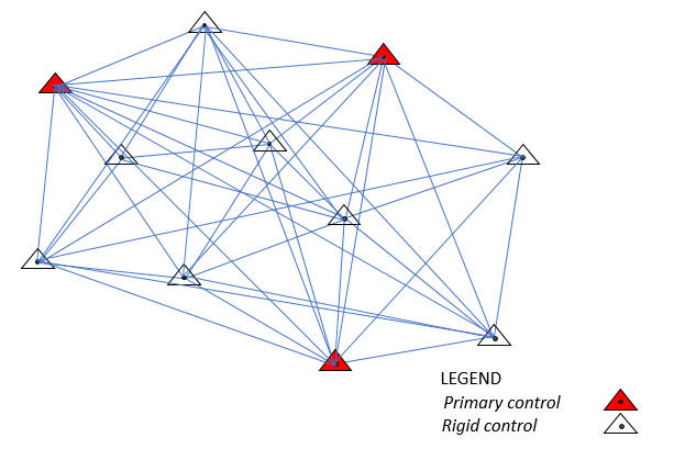
We use various modern survey equipment (GNSS/GPS) to establish ground and rigid control networks i {Plannimetric and Vertical (N,E,H)} to the highest accuracy for photogrammetric and construction purposes. In addition, with experienced geodesists, we determine appropriate transformation equations and parameters in transforming various coordinate types from one coordinates system to the other. We have established many ground/rigid controls on various projects which are in use for various survey works. Our ground control provision services meet national and international standards. The success of spatial projects, it is said depends largely on the quality of the controls used and this is the drive. Depend on us for your reliable survey controls.
Our proven track record in Nigeria and Africa as a whole was achieved by our dedicated highly skilled staff, huge investment in state-of-the-art survey equipment and technology. The advantages in using our services are custom solutions, leveraging our vast experience in optimizing project design and execution. Ultimately for cost-effectiveness and efficiency in survey operations to meet tight project timelines. Above all, absolute commitment to stringent Quality and EHS standards at all levels of our organization, fully supported by the Executive Management Team. This ensures results meet our in-house standards, international quality standards, and risk reduction to a practical minimum.
What Makes Us Different
Our vision is to become an established and professional GIS Company that will use the Technology to provide distinctive, universally recognized services which will have global impact and acceptability and produce the needed results with speed and essential qualities. Hence, the new name – Dynamic Geographic Information System (DGIS) Company.
Our mission is to apply the dynamism of Geographic Information System as follows:
- To conceptualize, plan, design, construct, operate and maintain society’s infrastructure for the Socio-Economic enhancement globally.
- To maintain/sustain a high standard of professional engagement through outstanding output that addresses the changing needs of society.
- To empower people gain technical and theoretical knowledge needed to excel and gain fulfillment in their field of study.
- To partner with both local and international outfits to provide a dynamic environment that emphasizes problem solving skills needed to meet their aims and objectives.
- To offer an exceptional applied ICT/GIS packages with broad coverage in: Database Management System, Programming, Construction Management, Computer Aided Design etc.
- To maintain natural and engineered Environment for Health and Safety, Constructability and sustainability.