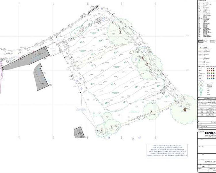
TOPOGRAPHIC SURVEYS
The specialized Geomatic engineering team at Diarsa Global is dedicated to providing topographical survey services that meet industry standards and project-specific requirements. We, work hand in hand with our clients to ensure tailored resulys are achieveid for all our topographical map clients. Boundaries, features/details both natural and man-made (above, on, and underground), spot heights are surveyed and represented to near reality with smart technologies. Achieving excellent results within schedule is thus, our hallmark. Maps produced are used as base maps for development, exploration, extraction, urban planning, record keeping (as-built), architecture, and several other purposes. We employ state-of-the-art technology to carry out topographical surveys in both accessible and inaccessible areas. A wide range of instruments is at our disposal to carry out the various forms of measurements on-site during topographical surveys. Instruments include GNSS receivers, UAVs, LiDAR, Total station, level Instruments, and others. Experience this for yourself by engaging us in your next project
What Makes Us Different
Our vision is to become an established and professional GIS Company that will use the Technology to provide distinctive, universally recognized services which will have global impact and acceptability and produce the needed results with speed and essential qualities. Hence, the new name – Dynamic Geographic Information System (DGIS) Company.
Our mission is to apply the dynamism of Geographic Information System as follows:
- To conceptualize, plan, design, construct, operate and maintain society’s infrastructure for the Socio-Economic enhancement globally.
- To maintain/sustain a high standard of professional engagement through outstanding output that addresses the changing needs of society.
- To empower people gain technical and theoretical knowledge needed to excel and gain fulfillment in their field of study.
- To partner with both local and international outfits to provide a dynamic environment that emphasizes problem solving skills needed to meet their aims and objectives.
- To offer an exceptional applied ICT/GIS packages with broad coverage in: Database Management System, Programming, Construction Management, Computer Aided Design etc.
- To maintain natural and engineered Environment for Health and Safety, Constructability and sustainability.

